Aerial Photos from 1926 to 1965

Scroll down for twenty Photographs

Back to Main Menu

Note; St. Mark's Church of Ireland then had a small tower, two years later the foundation stone was laid of the higher 'WW...

1

Note; St. Mark's Church of Ireland then had a small tower, two years later the foundation stone was laid of the higher 'WW I Memorial Tower' built by Collen Bros.

Aerial Photos of Portadown 1926 to 1965 - photo 1

2

Aerial Photos of Portadown 1926 to 1965 - photo 2

3

Aerial Photos of Portadown 1926 to 1965 - photo 3

4

Aerial Photos of Portadown 1926 to 1965 - photo 4

5

Aerial Photos of Portadown 1926 to 1965 - photo 5

6

Aerial Photos of Portadown 1926 to 1965 - photo 6

7

Aerial Photos of Portadown 1926 to 1965 - photo 7

8

Aerial Photos of Portadown 1926 to 1965 - photo 8

Aerial Photos of Portadown 1926 to 1965 - photo 9

8

Aerial Photos of Portadown 1926 to 1965 - photo 10

9

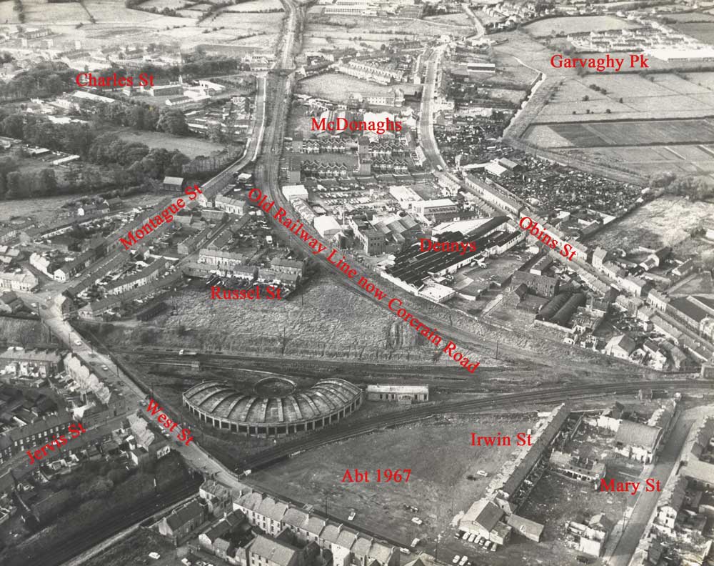
List of streets completely demolished in the mid to late 1960's

Curran St,, Irwin St., Mary St., Morrisons Court (off Mary St.) John St., David St., Fowlers Entry, Dawsons Court (off Woodhouse St.) Old Junction Row, Irish St., River Lane, Frances St., Marley St., Union St., Henry St., Margaret St., Russell St., Sarah St., Dawsons Row in Charles St. Bright St., Meadow Lane. Foundry St. Florence Court, Castle Ave.

Sections of these streets;  West St., Charles St., Montague St., Bridge St., Ormonde St., Obins St., Carrickblacker Rd., Sandy Row.

Below;  Tinted area completely demolished and re-developed.

Aerial Photos of Portadown 1926 to 1965 - photo 11

10

Aerial Photos of Portadown 1926 to 1965 - photo 12

11

Aerial Photos of Portadown 1926 to 1965 - photo 13

12

Aerial Photos of Portadown 1926 to 1965 - photo 14

13

Aerial Photos of Portadown 1926 to 1965 - photo 15

14

Aerial Photos of Portadown 1926 to 1965 - photo 16

15

Aerial Photos of Portadown 1926 to 1965 - photo 17

16

Aerial Photos of Portadown 1926 to 1965 - photo 18

17

Aerial Photos of Portadown 1926 to 1965 - photo 19

18

Aerial Photos of Portadown 1926 to 1965 - photo 20

19

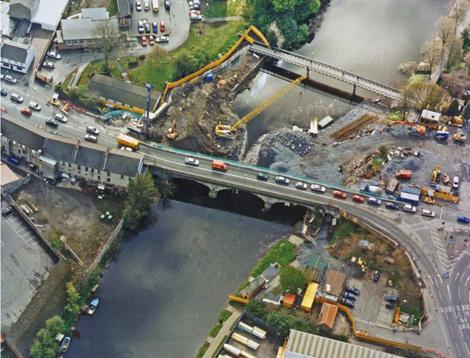
Aerial Photos of Portadown 1926 to 1965 - 20 Widening of Bann Bridge 2004-2006

20

Widening of Bann Bridge 2004-2006.

The other narrow bridge at top of photo was erected temporally for pedestrians crossing the river.

Back to Main Menu